
Portal:San Francisco Bay Area
The San Francisco Bay Area Portal.svg)  The San Francisco Bay Area (referred to locally as the Bay Area) is a populous region surrounding the San Francisco and San Pablo estuaries in Northern California. The region encompasses the major cities and metropolitan areas of San Jose, San Francisco, and Oakland, along with smaller urban and rural areas. The Bay Area's nine counties are Alameda, Contra Costa, Marin, Napa, San Francisco, San Mateo, Santa Clara, Solano, and Sonoma. Home to approximately 7.68 million people, the nine-county Bay Area contains many cities, towns, airports, and associated regional, state, and national parks, connected by a network of roads, highways, railroads, bridges, tunnels, and commuter rail. The combined statistical area of the region is the second-largest in California (after the Greater Los Angeles area), the fifth-largest in the United States, and the 43rd-largest urban area in the world with 8.80 million people. The Bay Area has the second-most Fortune 500 companies in the United States, after the New York metropolitan area, and is known for its natural beauty, liberal politics, entrepreneurship, and diversity. The area ranks second in highest density of college graduates, after the Washington, D.C. metropolitan area and performs above the state median household income in the 2010 census; it includes the five highest California counties by per capita income and two of the top 25 wealthiest counties in the United States. Based on a 2013 population report from the California Department of Finance, the Bay Area is the only region in California where the rate of people migrating in from other areas in the United States is greater than the rate of those leaving the region, led by Alameda and Contra Costa counties. (more...) Selected article Selected biography With Fred Archer, Adams developed the Zone System as a way to determine proper exposure and adjust the contrast of the final print. The resulting clarity and depth characterized his photographs. Adams primarily used large-format cameras because their high resolution helped ensure sharpness in his images. Adams founded the photography Group f/64 along with fellow photographers Willard Van Dyke and Edward Weston. (more...) Selected city The city is one of the major cities that make up the Silicon Valley located in the San Francisco Bay Area. It is the seventh most populous city in the San Francisco Bay Area. Sunnyvale is bordered by portions of San Jose to the north, Moffett Federal Airfield to the northwest, Mountain View to the west, Los Altos to the southwest, Cupertino to the south, and Santa Clara to the east. It lies along the historic El Camino Real and Highway 101. As part of the Silicon Valley, high-tech companies such as Juniper Networks, Fortinet, AMD, NetApp, Spansion, Yahoo!, AppliedMicro and Ariba are headquartered there. Sunnyvale is also home to several aerospace/defense companies; Lockheed Martin has a major facility in Sunnyvale, and Honeywell, Northrop Grumman Electronic Systems - Marine Systems (formerly Joshua Hendy Iron Works), Finisar, and Spirent also have offices in Sunnyvale. Sunnyvale was also the home to Onizuka Air Force Station, where its memorial building was locally known as the Blue Cube. The base, named for the deceased Space Shuttle Challenger astronaut Ellison Onizuka, was an artificial satellite control facility of the United States armed forces until August 2010. (more...) Selected image
The Bay Area by year1935
   • The San Francisco Museum of Art opens at the War Memorial Veterans Building on Van Ness Avenue in the Civic Center (Woman with a Hat by Matisse, from the museum collection, pictured, left) Selected historical image image credit: Larry Rogers
Did you know... San Francisco Bay Salt Ponds
Previous Did you know..._Picnic_Area.JPG)   • ... that Live Oak Park is one of Berkeley's oldest and most naturalistic public parks? (park fireplace pictured) March 2015 Selected periodic event Treasure Island Music Festival is an annual two day music festival that takes place on Treasure Island. The first day of the festival consists of electronica and hip hop/rap influenced performers while the second day consists of rock and indie rock influenced performers. (Dr. Dog pictured) Quote
Selected multimedia fileBay Area regions, geographic features and protected areasGeographic features
        Related PortalsWikiProject
Things you can do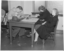 *Write an article on a Bay Area-related subject Selected panoramaSan Francisco Bay Area categoriesBay Area | San Francisco Bay | San Francisco | San Jose | Oakland | Cities | Census-designated places | Historic Places | National Landmarks | Counties: Alameda | Contra Costa | Marin | Napa | San Mateo | Santa Clara | Solano | Sonoma
Architecture | Attractions | Books | Culture | Economy | Education | Environment | Events & Festivals | Geography | Government | History | Landmarks | Law | Mass media | Military | Music | Organizations | Parks | People | Politics | Science | Sports | Transport
Full category tree
Select [►] to view the full category tree.
Associated WikimediaThe following Wikimedia Foundation sister projects provide more on this subject:
Discover Wikipedia using portals |
.jpg)


.jpg)

.jpg)


.jpg)


.JPG)


- All portals
- San Francisco Bay Area portal
- San Francisco Bay Area portal selected article pages
- San Francisco Bay Area portal selected biography pages
- San Francisco Bay Area portal selected city pages
- San Francisco Bay Area portal selected picture pages
- San Francisco Bay Area portal years pages
- San Francisco Bay Area portal selected historical image pages
- San Francisco Bay Area portal did you know pages
- San Francisco Bay Area portal festivals pages
- San Francisco Bay Area portal quotes pages
- San Francisco Bay Area portal selected multimedia pages
- San Francisco Bay Area portal selected panorama pages
- California portals
- San Francisco Bay Area
- United States portals by city